
The Blue Room
Pictures & Maps
Here can be found various illustrations of Imperial documents (with translations) and several city maps.
These images cannot be reproduced without permission.
pic_BeySu.jpg
by Professor Barker
Illustration/Map for the city of Béy Sü (from the box for Empire of the Petal Throne)
BeySu.pdf
by Professor Barker
Adobe Acrobat 4.0.
Translation.
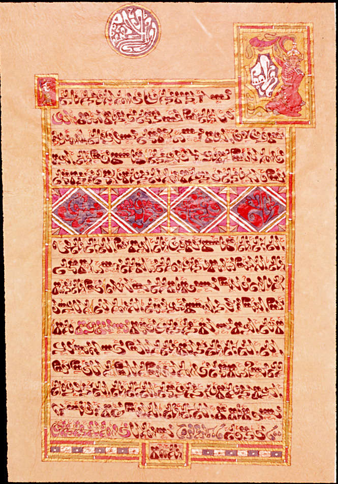
pic_ExplorationPermit.jpg
by Professor Barker
Imperial document.
ExplorationPermit.pdf
by Professor Barker
Adobe Acrobat 4.0.
Translation.
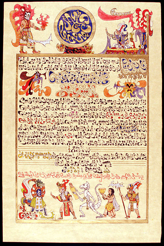
pic_KerunanGrant.jpg
by Professor Barker
Imperial document.
KerunanGrant.pdf
by Professor Barker
Adobe Acrobat 4.0.
Translation.
pic_MirusiyaLetter.jpg
by Professor Barker
Imperial document.
MirusiyaLetter.pdf
by Professor Barker
Adobe Acrobat 4.0.
Translation.
pic_SwampFolk.jpg
Illustration.
map_Fasiltum.gif
City map.
map_SaaAllaqiyar.gif
City map.
map_Setnakh.gif
City map.
map_Thriil.gif
City map.
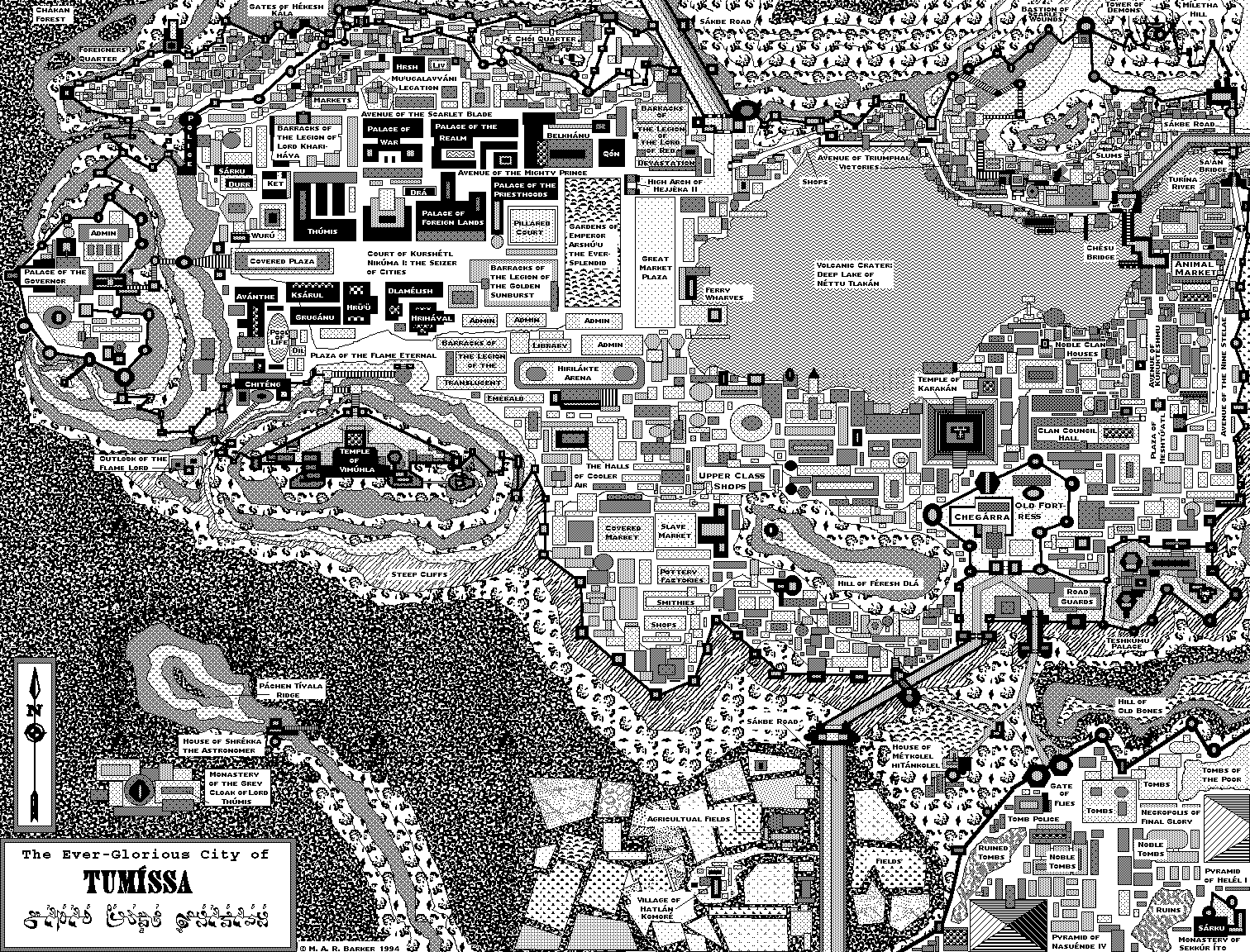
map_Tumissa.gif
City map.
